

I’m always looking for the newest thing to help me procrastinate; in fact I’m doing it right now. I also love maps and the application of GPS and other sources of data with them to create interactive experiences fascinates me.
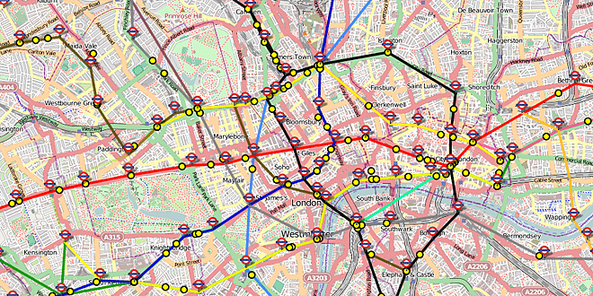
A collection of maps at Accessible UK Train Timetables show the approximate real-time positions of trains on the London Underground (there’s also a Skyfall style map designed like the one seen in the film), and those at and surrounding many major UK stations. The map uses live departure data taken from the Transport for London API and National Rail to show where the train is on the map which is marked by a moving yellow dot, assuming it’s running on time of course (which is where the system falls down). Even so, watching the London Underground at rush hour is a sight to behold.
My mother lives opposite a section of railway covered by one of the maps so I tested the system’s accuracy by having her watch the track while I watched the map. Two trains appeared at her house exactly as their dots passed it on my screen, one (a late runner) appeared for her a few minutes after it appeared for me, and two passed her house without ever appearing on screen.
It’s a long way from perfect but if you’re after a distraction it’ll certainly keep you entertained.


Man, I’d love that for the NYC subway!